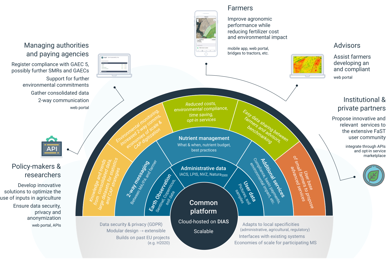
The tool will enable the addition of other software or additional services that can be interfaced with the FaST and will promote data-driven farming and farm management. FaST could provide the digital environment for a one-stop shop with all services gathered together. Commercial actors could offer their services as additional solutions to download.
FaST will be interoperable with other databases such as the IACS for farmer log-in for example, and will be capable of integrating any type of compliance layer and interface standard, even highly specialized ones.
The FaST will be cloud-native. This architecture facilitates high availability and adaptation to geographic localisation for users.
FaST is built on top of open-source software, which increases the support available in the vibrant cloud-native community, avoids vendor lock-in and facilitates the future open-sourcing of the FaST modules and architecture. All the building blocks implemented in FaST are open-source, and free.
The FaST platform will offer farmers a user-friendly access to satellite imagery and other data for their parcels. Copernicus satellite imagery (such as Sentinel 2) will be made available both in the web portal and in the mobile application, and will be pulled directly from the underlying DIAS. The browsing mechanism will allow the user to take advantage of the high repeat rate of Sentinel imagery and go back and forth in time in a user-friendly manner.
As the FaST platform will provide access to libraries of code, the tool will be customized by the Paying Agencies, to offer additional functionalities or to adapt to Member States specificities at national, regional or local level (e.g. language, regulations, data sources, etc.).
