Supported by the European Commission’s DG Agriculture and Rural Development, by the EU Space Programme (DG DEFIS) and by the EU ISA2 Programme (DG DIGIT), the FaST digital service platform will make available capabilities for agriculture, environment and sustainability to EU farmers, Member State Paying Agencies, farm advisors and developers of digital solutions.
The vision is for the FaST to become a world-leading platform for the generation and re-use of solutions for sustainable and competitive agriculture based on space data (Copernicus and Galileo) and other data public and private datasets. The modular platform will support EU agriculture and the Common Agricultural policy by also enabling the use of solutions based on machine learning applied to image recognition, as well as the use and reuse of IoT data, various public sector data, and user generated data.'

We are happy to announce that Stage 2 of the FaST project will expand the reach of the platform to the farmers of:
Kick-off meetings are being organized within the month of June, and this second stage is expected to be completed by the end of May 2022.
The Paying Agencies that participated in the first stage of the project (Andalucia , Castilla y Leon
, Estonia
and Piemonte
) will continue to be supported in the running of their platform, throughout the course of Stage 2.
March 30th 2020
We are happy to announce that FaST v1.0 has been released to the currently participating regions of the project.
This v1.0 mobile application embarks the following features in a user-friendly interface:
The platform also provides an Administration Portal where the Paying Agency can access the regional data, configuration and user profiles and a secured API mechanism to remotely connect to the datastore.
Paying Agencies, contact us to obtain test credentials to trial the app and be granted read-access to the administration portal.
You can also download the slides of the FaST Year 1 closing meeting.
FaST will help lay the foundations of a comprehensive digital ecosystem for sustainable farm and land management in Europe. It will support farmers in their administrative decision-making processes, for farm profitability and environmental sustainability. At the same time, it will provide a reliable on-farm landing spot for digital solution developers (including satellite-based solutions) and service providers. It will reduce administrative burdens for farmers and Paying Agencies, and streamline communication between the farmers and public authorities.

All farm data in the palm of their hands
Simplified tasks

Data-informed action
Direct communication to farmers
.svg)
More information on their members
Better support and coordination

Data for designing and monitoring policy measures

Research inputs
Link to farms

Opportunities to engage farmers in innovative environmental action

Market pull from public sector clients
Direct marketing to farmers

The Common Agricultural Policy (CAP) is the largest and most promising use case for solutions based on Copernicus and Galileo in the public sector. With farming being one of the main economic sectors using such data, further realising its potential depends on adequate data sharing and solution interoperability and integration....
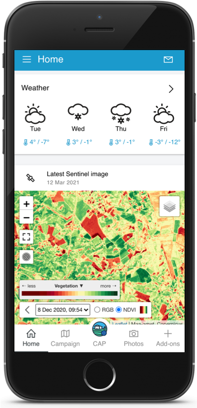
FaST users (farmers, Paying Agencies etc) interact with the platform through a custom mobile application and web portals accessible from any internet-connected computer.
 (1).png)
The FaST mobile app surfaces Copernicus and Galileo capabilities to the farmer
 (3).png)
The FaST mobile app acts as a landing point for multiple CAP and environment-related use cases
 (2).png)
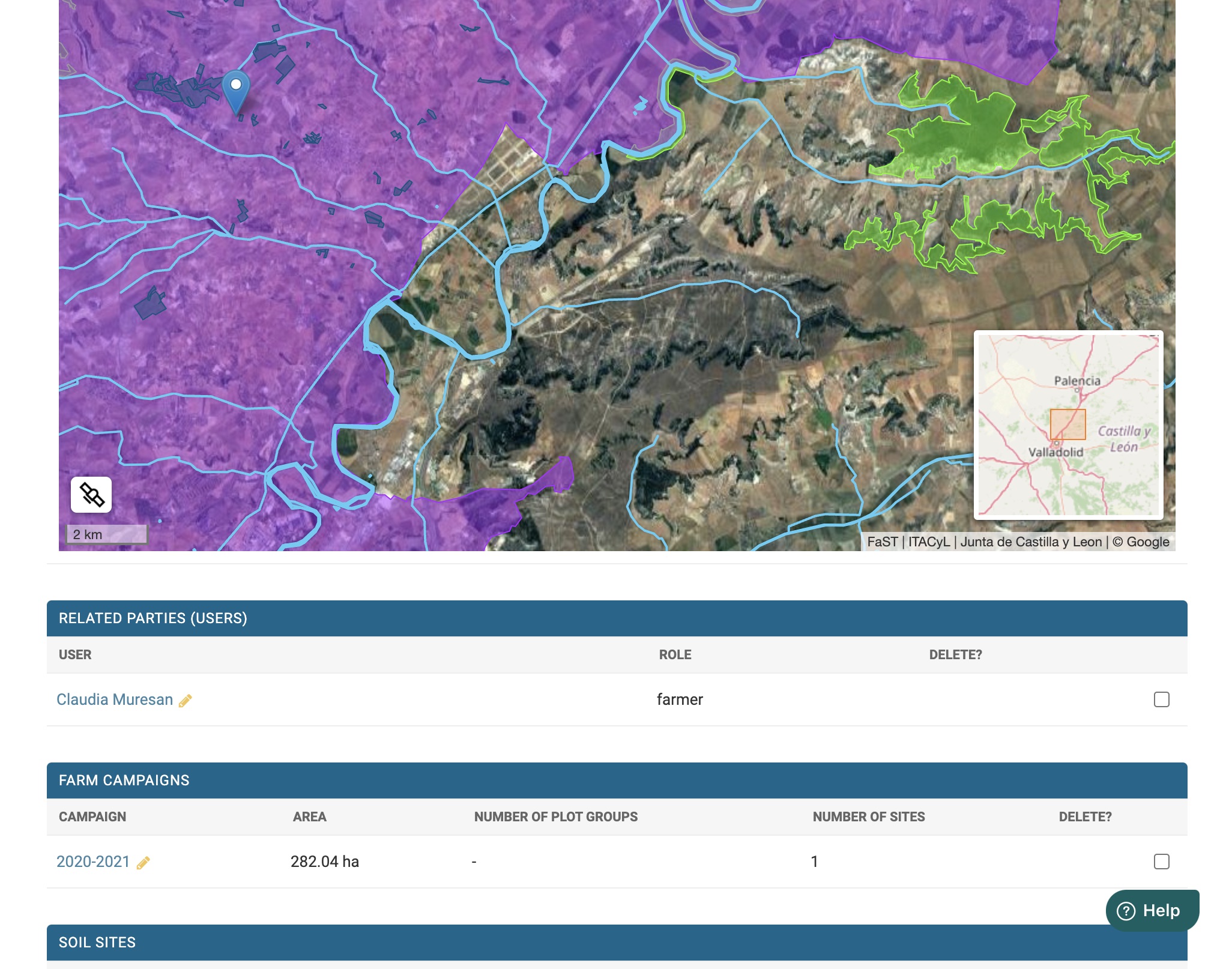
The parcels of the farmer are displayed with regulatory layers such as NVZ and Natura2000
 (5).png)
Fertilization advice is provided through a user-friendly interface

The FaST platform integrates multiple heterogeneous data sources from participating Member States

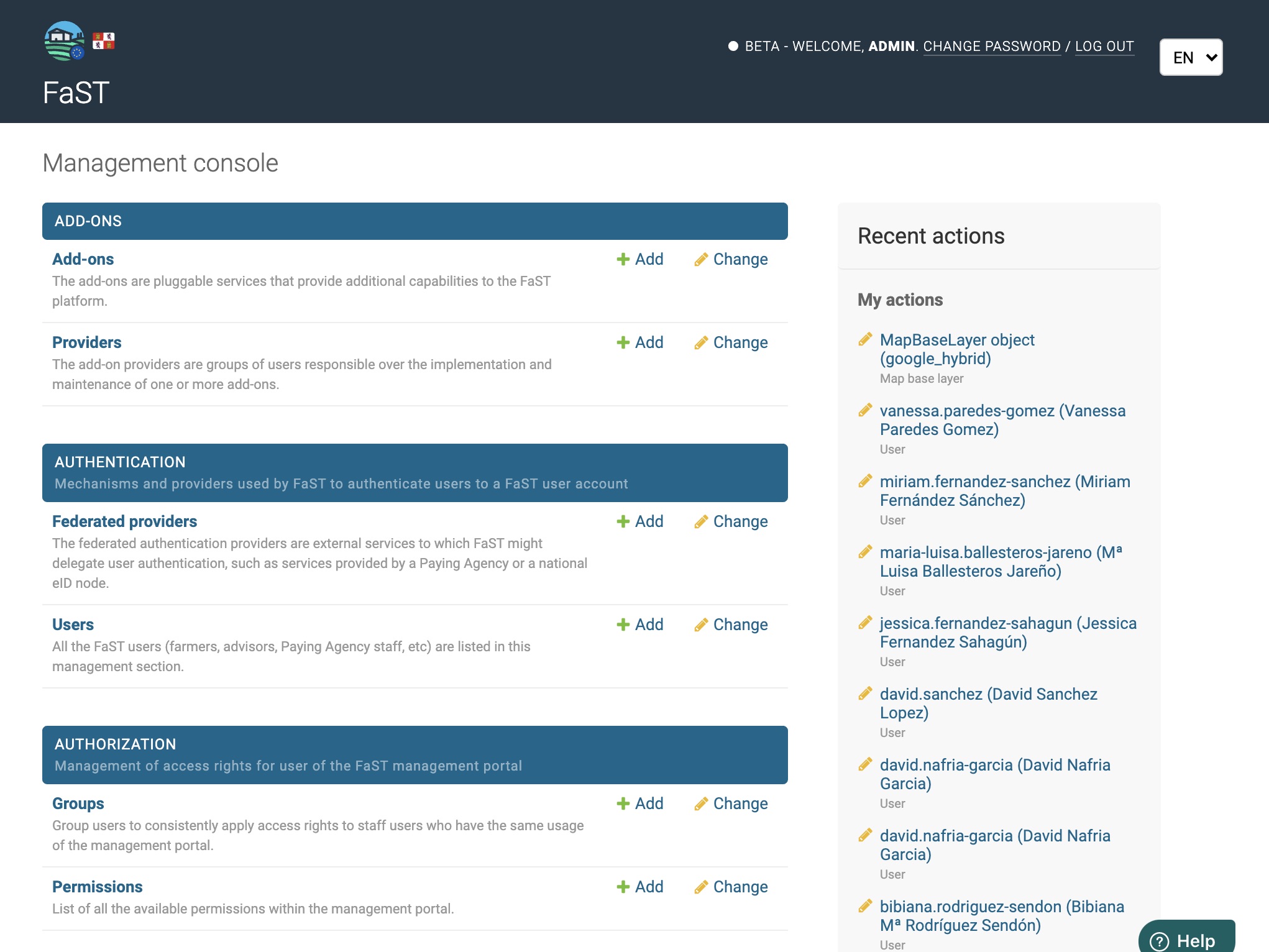
The Paying Agencies access the platform through a web portal, where they can, amongst other things, manage users and directly communicate with them.
- Iterative releases of the mobile app and Adminstration Portal
- Deployment of 3 authentication mechanisms: OPCyL (Castilla y Leon), DAT (Andalucia) and TARA (Estonia).
- Deployment of the 4 IACS connectors: OPCyL (Castilla y Leon), REAFA (Andalucia), ARPEA (Piemonte) and PRIA (Estonia)
- Iterative upgrades on the fertilizations algorithms, mainly Fertilicalc (up to product recommendation) and Visione
- Implementation and deployment of a WMS connections service, with on-the-fly reprojection and caching
- Implement mechanisms to request and store consent (privacy policies, data access) from users
- Implement screens to initialize a campaign based either on IACS data from the previous year or from a duplication of an exisitng campaign
- Implement screens to add or remove plots (and associated crops) from a campaign
- Implement screens for the edition of farm soil samples
- Added password reset workflows for the FaST identity provider
- Improve the RGB/NDVI map widget to show cloud cover and legend
- Added push + email notifications for users whose email has been provided to FaST
- Deployed the FaST app as a webapp to be used in a browser (mobile + laptop)
- Improve the Administration Portal (navigation, stability, add maps), add user documentation
- Add more details to the weather widget in the app
- Add more details to plot constraints widget (NVZ, hydrology, etc)
- Implement and deploy external access to the API via API keys
- Improve map caching and maps performance in general
- Usability improvements and fixes in the app and in the Administration Portal
- A clarification and Q&A meeting was held with Member States interested in participating in the second phase of the project
- The meeting was attended by representatives of Slovenia, Belgium (Wallonia), Slovakia, Lithuania, Poland, Bulgaria, Croatia, Romania, Greece
- Deployment of the platform on a production infrastructure
- Preparation of a stagin environment based on Kubernetes 1.15
- Tests and validation of the cluster autoscaling mechanism
- Deploy automatic alerting and telemetry mechanisms on the cluster
- Finalization of CI/CD pipelines for the FaST backend services
- Development of front-end (mobile) layout for Fertilicalc
- Improvements on the geo-tagged picture usability (mobile app)
- Implement the possibility for MS to add their own custom WMS layers to the mobile app and admin portal maps
- Improvements to the authentication process to take into account specificities of federated providers like SPID (Italy)
- Improvements to the security of the FaST authentication (anti brute force)
- Development of backend services for push notifications handling
- Implement language selection and automatic switch, in the mobile app
- Development of front-end (mobile app) screens for the Visione fertilization algorithm (Piemonte)
- Preparation of database initialization files for Estonia, Piemonte and Andalucia
- Development of weather service based on ARPA (Piemonte) (current status: backend developed)
- Migration of the picture storage service from shared disk to S3 + authenticated proxy
- Improvements to the NDVI tiling service (apply cloud mask, dynamic coloring on the front-end, reprojections)
- Improvements to translations in the mobile app and admin portal (through professional translation services)
- Support to Andalucia and Estonia for the development of their authentication and/or IACS APIs
- Documentation: continue developing the documentation for the deployment of the platform
- Documentation: improvements to the source code docs for completed services (readme files)
- Preparation for the release of the mobile app under an EC account on the Google Play Store and Apple App Store
- Release of the first beta version of the mobile app and admin portal for Castilla y Leon
- First demo of the current state of development of the platform during a webinar.
- Recording and slides are available at the top of this page.
- The demo was attended by over 180 participants from the public sector of European Member States (Agriculture ministries, CAP Paying Agencies, Agricultural Research Centers), European institutions (JRC, GSA) and private actors who where interested in the interconnection capabilities offered by the platform.
- Cluster deployment using Kubernetes 1.15 and implementation of the GitOps handlers
- Setup Continuous Integration and Continuous Deployment pipelines for the FaST backend services
- Finalize import of external/public data sources into FaST for the 4 participating regions: hydrography, Natura2000, nitrate vulnerable zones, soil data, etc
- Implementation of vector tiling servers for public GIS data and farmer parcels
- Implementation of API gateways based on GraphQL technology, with authentication and permissions
- Technical accompaniment of participating MS for the development of their APIs to access IACS data for farmers and to authenticate farmers
- Development of connector for the Castilla y Leon authentication system (paying agency)
- Development of connector for the Castilla y Leon IACS APIs (paying agency)
- Development of connector for the Piemonte IACS APIs (paying agency) (currently based on samples)
- Development of fertilization service based on Fertilicalc (Spain): (current status: backend developed+ 70% of front-end)
- Development of fertilization service based on Vegsyst (Spain) (current status: backend developed)
- Development of fertilization service based on Visione (Piemonte) (current status: backend developed)
- Development of RGB/NDVI tiling service based on Sentinel L2A products from Sobloo DIAS (current status: backend & front-end developed)
- Development of weather service based on SiAR and AEMET (Spain) (current status: backend developed)
- Development of weather service based on Ilmateenistus (Estonia) (current status: backend developed)
- Development of mobile application for Android and iOS (Current status: 50% developed)
- Development of paying agency web portal (Current status: 70% developed)
- First pass on the algorithmic implementation of the regulation on NVZ and non-NVZ in each of the 4 pilots
- Documentation of architecture and system: work in progress, available on the code repository
- Necessary preparations to open the source code repositories to the general public (security review, permissions, etc)
- Continued on Journey Documentation: report targeting PA/MSs interested in joining the project
- Collection of agricultural algorithms from all pilots
- Conduction of technical analysis of algorithms
- Implementation and tests of Fertilicalc (Spain) and Visione (Italy) algorithms
- Identification of available data sources from each pilot: first integrations of Natura2000, NVZ and hydrology layers as well as soil databases/GIS layers in the platform
- Identification of the desired identity providers/ authentication systems for each MS/MA/PA ; implementation of FaST connectors for SPID (Italy), TARA (Estonia), OpCyl (Castillla y Leon)
- Liaison with participating regions for the development of the necessary IACS APIs
- Deployment of the cluster infrastructure on the Sobloo DIAS: service mesh, security, continuous integration and deployment
- Development of weather service connector for Spain (SiAR + AEMET)
- Scaffolding of the mobile app / website, review of the EGNSS4CAP GSA geotagged photos app
- Review of regulation on NVZ and non-NVZ in each of the 4 pilots, to customize the tool accordingly
- Definition of the FaST data model, partly based on Inspire and the Estonian eFieldbook study
 Castilla y Leon user workshops #1 in Valladolid, Spain
 Andalusia user workshops #1 in Sevilla, Spain
 Piedmont user workshops #1 in Torino, Italy
 Estonia user workshops #1 in Tallinn, Estonia
This EU-supported action will result in customized, operational tools for farmers in the participating Member State Paying Agencies to provide to farmers.
If you are interested in finding out how to participate:

European Commission
DG DEFIS

European Commission
DG AGRI

European Commission
DG DIGIT / ISA2

PwC France
FaST delivery team